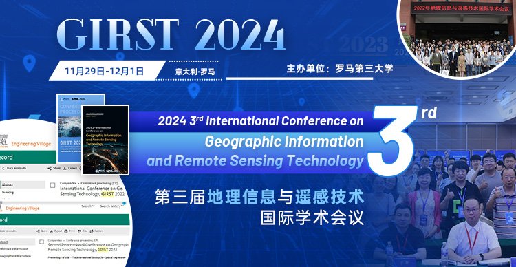
第三届地理信息与遥感技术国际学术会议
2024 3rd International Conference on Geographic Information and Remote Sensing Technology
大会简介
第三届地理信息与遥感技术国际学术会议(GIRST 2024)将在2024年11月29日-12月1日于意大利罗马召开。大会旨在为从事地理信息与遥感技术的专家学者、工程技术人员、技术研发人员提供一个共享科研成果和前沿技术,了解学术发展趋势,拓宽研究思路,加强学术研究和探讨,促进学术成果产业化合作的平台。大会诚邀国内外高校、科研机构专家、学者,企业界人士及其他相关人员参会交流。
主办单位
罗马第三大学
罗马第三大学简称罗马三大(另有罗马第一大学、罗马第二大学),成立于1992年,是罗马最年轻的一所国家公立大学,但就学生人数、教职工人数和校园占地面积而言,却是罗马城内规模第二的大学。罗马三大的诞生,是基于时下意大利希望接受高等教育的人群猛增这一现状。为了满足大学教育的巨大需求,十多年来,罗马三大做出了不懈的努力,注册学生由建校伊始的7,000人增长到40,000人,教师和行政人员的人数也在大幅度增加,现有人数分别都超过了1000名。1999-2000学年度校内师生人数比率为1:40,略高于全国平均水平1:33。
主讲嘉宾
Fabio Tosti教授
西伦敦大学
Fabio Tosti(IEEE M’17-SM’19)于2010年获得意大利罗马特雷大学基础设施和交通工程硕士学位(优等),并于2014年在罗马特雷大学获得土木工程博士学位,获得欧洲博士标签(优等)。为注册特许工程师,英国伦敦西伦敦大学(UWL)计算机与工程学院的土木工程教授,并担任UWL的 "法灵顿无损检测和遥感研究中心 "的主任。研究兴趣包括为地球科学应用开发新的算法、方法和模型,以及对民用和绿色基础设施进行非破坏性和卫星遥感评估、修复和维护。在国际期刊、会议和书籍中撰写/合作撰写了220多篇研究发表记录,并发表了许多主题演讲和特邀演讲。
陶明亮教授
西北工业大学
1989年8月生,湖南株洲人,汉族,工学博士,教授,国家级青年人才。2007年至2016年在西安电子科技大学学习,陆续获得工学学士、硕士、博士学位。2016年7月进入西北工业大学电子信息学院任教。先后入选国家级青年托举人才、陕西省青年科技新星、全国博士后创新人才计划,连续两届国际无线电科学联盟(URSI)“Young Scientist Award”获得者。博士论文被评为“陕西省优秀博士学位论文”和“首届中国电子教育学会优秀博士学位论文”。先后获省部级一等奖2项、全国“博新计划”十大创新成果。2024年1月任西北工业大学电子信息学院副院长。
征稿主题
01. 地理信息:地理地质信息化,地理信息技术在地理环境/地质学/岩土、矿产和能源资源上的开发和应用,地球探测与信息技术,地质结构/构造演化遥感解译 ,地质灾害预测、评估、控制,地球探测与信息技术,地理信息系统(GIS),全球导航卫星系统(GNSS),卫星导航和定位等;
02. 测量与测绘:测绘学,海洋测绘,摄影测量,大地测量,水文测量,矿山测量工程测量,重力测量,航空摄影测量,地图制图,城市大脑、智慧海洋与数字地球,计算机图形学,精密仪器制造,图形图象复制技术,传感器技术,测绘技术,测绘仪器,考古测绘等;
03. 遥感:测绘、导航与倾斜摄影等相关的理论、技术与方法,遥感(RS),光学遥感,微波遥感,大气环境遥感,行星遥感与测图,冰冻圈与水圈,地理信息科学,遥感信息工程,空间数据库,地球监测与制图,空间技术与景观,分类和数据挖掘技术,图像处理技术,高光谱影像处理,遥感数据融合,遥感数据质量,遥感模式分析;
论文出版
1、会议论文集(截稿:2024年9月20日)
所有的投稿都必须经过2-3位组委会专家审稿,经过严格的审稿之后,最终所有录用的论文将由会议论文集出版,见刊后由出版社提交至 EI Compendex, Scopus 检索。
在线投稿
论文模板
2、SCI期刊(长期征集)
* 额外征集优秀论文发表到SCI期刊,录满截止,欢迎投稿!
* SCI论文排版在初判阶段暂无严格要求,投稿前请先联系AEIC-李老师,通过审核后再正式投稿。
2、其他英文期刊
期刊名称:ASEAN Journal on Science and Technology for Development [0217-5460 (P); 2224-9028 (O)]
本刊旨在促进和加速在整个东盟地区发现和实施科学和技术方面的最新进展,最终目标是促进该地区居民的繁荣。它涵盖了各种类别的广泛主题,包括数据科学,能源,工程,健康科学,材料科学,以及自然和生命科学。
收录数据库:
Scopus
Google Scholar
DOAJ
- Welcome to GIRST 2024 -
The organizing committee has decided to postpone the conference to November 29–December 1, 2024, in order to better accommodate the growing number of participants and organizations.
2024 3rd International Conference on Geographic Information and Remote Sensing Technology (GIRST 2024) is hosted by Università Roma Tre . The conference will be held on November 29 to December 1, 2024 in Rome, Italy. GIRST 2024 is to bring together innovative academics and industrial experts in the field of geographic information and remote sensing technology to share their latest research findings and exchange their insights on the development of the related disciplines. We cordially encourage past and aspiring authors to submit their works to GIRST 2024 so that you can share your insightful research experiences with fellow academics and scientists worldwide.
2022 International Conference on Geographic Information and Remote Sensing Technology (GIRST 2022) had been held in Kunming, China during September 16-18, 2022. GIRST 2022 was hosted by Yunnan Normal University.
Supported by The Faringdon Research Centre for Non-Destructive Testing and Remote Sensing, University of West London, UK and Yangtze University and CI-HEAM/Mediterranean Agronomic Institute of Chania, Greece, the conference, 2023 2nd International Conference on Geographic Information and Remote Sensing Technology (GIRST 2023) had been held during July 21-23, 2023 in Qingdao, Shandong, China.
Full Paper Submission Date
Sep. 20, 2024
Notification of Acceptance Date:
Oct. 15, 2024
Final Paper Submission Date
Oct. 30, 2024
Final Registration Date
Nov. 13, 2024
Conference Date
Nov. 29-Dec. 1, 2024
- CALL FOR PAPERS -
Topics of interest include but are not limited to
·Geographic Information
·Geo-geological Information
·The Development and Application of Geographic Information Technology in Geographical Environment/geology / rock and Soil, Mineral and Energy Resources
·Geohazards & Earthquake engineering
·Remote Sensing Interpretation of Geological Structure/Tectonic EvolutionEarth
·Detection and Information Technology
·Geohazards & Earthquake engineering
·Geographic Information System
·Global Navigation Satellite System
·Satellite Navigation and Positioning
·Surveying & Mapping
·Surveying and Mapping
·Marine Mapping
·Photogrammetry
·Geodetic Survey
·Hydrological Survey
·Mine Survey
·Engineering Survey
·Gravity Measurement
·Aerial Photogrammetry
·Cartography
·City Brains, Smart Oceans and Digital Earth
·Computer Graphics
·Precision Instrument Manufacturing
·Graphic Image Copy Technology
·Sensor Technology
·Mapping Technology
·Surveying and Mapping Instruments
·Archeological Mapping
·Remote Sensing Technology
·Theories, Techniques and Methods related to Surveying, Mapping, Navigation and Oblique Photography
·Remote Sensing
·Optical Remote Sensing
·Microwave Remote Sensing
·Remote Sensing Of Atmospheric Environment
·Planetary Remote Sensing and Mapping
·Cryosphere and Hydrosphere
·Geographic Information Science
·Remote Sensing Information Engineering
·Spatial Database
·Earth Monitoring and Mapping
·Space Technology and Landscape
·Classification and Data Mining Techniques
·Image Processing Technology
·Hyperspectral Image Processing
·Remote Sensing Data Fusion
·Remote Sensing Data Quality
·Analysis Of Remote Sensing Models
PUBLICATION
Submitted paper will be peer reviewed by conference committees, and accepted papers after registration and presentation will be published in the Conference Proceedings, which will be submitted for indexing by Ei Compendex, Scopus.


