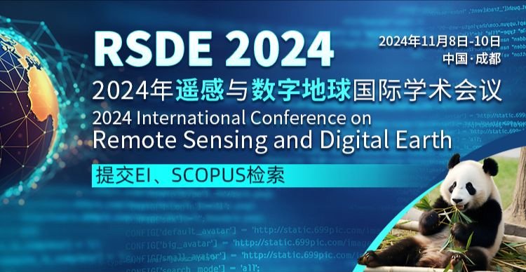
2024年遥感与数字地球国际学术会议
2024 International Conference on Remote Sensing and Digital Earth
大会介绍
2024年遥感与数字地球国际学术会议(RSDE 2024)定于2024年11月8-10日在中国·成都隆重举行。本次会议旨在汇聚全球顶尖学者、研究人员和行业专家,共同探讨遥感技术与数字地球科学的最新进展与应用。会议将覆盖多个主题,包括但不限于卫星遥感、地理信息系统(GIS)、环境监测、灾害预警、土地利用与覆盖变化、以及智慧城市建设等。通过主题演讲、论文展示、专题讨论和实地考察,与会者将有机会分享最新研究成果,交流创新理念,探索未来发展方向。RSDE 2024将为参会者提供一个高端的学术交流与合作平台,助力全球遥感技术与数字地球科学的发展与进步。我们诚邀相关领域的专家学者积极参与,共同推动遥感与数字地球技术的创新与应用。期待您的光临,与我们共同迎接这个激动人心的学术盛会!
支持单位
中国矿业大学
桂林理工大学
University of Tehran
主讲嘉宾
桂林理工大学,周国清教授,副校长
周国清,教授,博士生导师,桂林理工大学副校长,地球科学学院、测绘地理信息学院教师。1986年获东华理工大学学士学位,1991年获西南交通大学硕士学位,1994年和2011年分别获得武汉大学和美国弗吉尼亚理工大学博士学位。国家级重大人才项目入选者,国家“十二五”863计划主题专家、国家有突出贡献的中青年专家、广西院士后备人选。主要研究方向是三维激光雷达(LIDAR)、卡斯特地区地表湿度遥感反演、高分辨率遥感数据处理。
西南交通大学,张淳民教授
张淳民,西安交通大学二级教授,博士生导师,现任西安交通大学空间光学研究所所长。国家基金委第十二届、十三届专家组成员,国家科技奖评审专家,教育部科技奖评审专家,陕西省三秦人才,陕西省优秀博士指导教师,西安交通大学教学名师。中国光学学会理事,中国光学工程学会理事,中国光学学会空间光学专业委员会顾问,全国高校光学研究会副理事长,全国高校电磁学研究会副理事长,陕西省光学学会副理事长等。主要研究领域是空间光学、成像光谱技术、光学遥感探测技术、大气光学、光电图像处理、先进光学仪器。
中国矿业大学,余科根教授,IEEE senior member
余科根教授1983年获长春地质学院(现吉林大学)仪器专业工学学士学位,1999年获澳大利亚国立大学机器人专业工学硕士学位,2003年获澳大利亚悉尼大学电气信息工程系工学博士学位。现为中国矿业大学环境与测绘学院教授,国际电气电子工程师协会(IEEE)高级会员,国际大地测量协会GNSS-R工作组成员,IEEE航空航天与电子系统协会导航系统技术组成员。主要研究领域是无线定位技术、室内定位与导航、GNSS遥感、信号处理。
武汉大学,袁强强教授
袁强强,武汉大学测绘学院教授,博士生导师,航空航天测绘研究所党支部书记,测绘工程系副主任。 入选国家高层次青年人才,科睿唯安”全球高被引学者”。担任International Journal of Applied Earth Observation and Geoinformation(JAG)、European Journal of Remote Sensing、Remote Sesning、Computational Intelligence and Neuroscience 、IEEE Access、Sensors、《遥感学报》、《遥感技术与应用》等国内外期刊的副主编或编委。主要从事遥感影像质量改善、信息融合与定量遥感等方面的教学和研究工作。
Mahmoud Reza Delavar,University of Tehran
Mahmoud Reza Delavar教授为测绘工程卓越中心主任,智慧城市实验室灾害管理和土地管理主任。他是德黑兰大学工程学院的教授。自2006年以来,他是国际城市数据管理协会(UDMS)的国家代表。主要研究方向为空间数据质量和不确定性建模、时间GIS、灾害管理、智慧城市、地籍、土地管理、空间数据基础设施(SDI)、建筑信息建模/管理(BIM)、泛在GIS、空间互操作性、空间数据融合、空间数据科学、智能GIS、城市增长建模、土地利用和土地覆盖变化建模、遥感与GIS集成。
昆明理工大学,田安红教授
田安红,女,教授,工学博士,硕士生导师,云南省中青年学术和技术带头人后备人才,云南省女科技工作者协会理事,CAA分数阶系统与控制专委会委员,昆明理工大学高层次引进人才(四层次),曾就职于华为公司从事软件研发工作。主持国家自然科学基金2项,云南省科技厅等各类项目10余项,获云南省研究生优秀科技创新成果奖1项。近年来,在IEEE TGRS、 INT J BIFURCAT CHAOS、REMOTE SENSING、光谱学与光谱分析等国内外期刊发表SCI收录论文30余篇。指导学生参加学科竞赛获省级以上奖励10余项。
受邀嘉宾
【大会主席】
王勇教授,电子科技大学 斯坦福大学和爱思唯尔发布的全球顶尖2%科学家
李彦胜教授,武汉大学 国家青年人才计划获得者
【技术委员会主席】
姚剑教授,武汉大学 湖北省“楚天学者”特聘教授
周国清教授,桂林理工大学 桂林理工大学副校长
【出版主席】
余科根教授,中国矿业大学 IEEE高级会员
程洁教授,北京师范大学
Mahmoud Reza Delavar教授,University of Tehran
田安红教授,昆明理工大学
【大会主席】
王勇教授,电子科技大学 斯坦福大学和爱思唯尔发布的全球顶尖2%科学家
李彦胜教授,武汉大学 国家青年人才计划获得者
【技术委员会主席】
姚剑教授,武汉大学 湖北省“楚天学者”特聘教授
周国清教授,桂林理工大学 桂林理工大学副校长
【出版主席】
余科根教授,中国矿业大学 IEEE高级会员
程洁教授,北京师范大学
Mahmoud Reza Delavar教授,University of Tehran
田安红教授,昆明理工大学
出版信息
所有的投稿都必须经过 2-3 位组委会专家审稿,经过严格的审稿之后,最终所有被录用的稿件将提交出版社出版,出版后提交EI Compendex 和 Scopus 检索。
征稿主题(包含不限于)
测绘、导航与倾斜摄影等相关的理论,大数据分析与处理技术,地理科学, 环境遥感地理信息技术,数字图像处理技术,地图学, 大气环境遥感,变形监测数据处理技术,城市空间信息学, 陆地环境遥感,遥感技术在地质矿产勘查中的应用,数字测图,水环境遥感,遥感数据融合及应,摄影测量学 / 大地测量学 / 工程测量学, 植被生态遥感,使用传感器技术来检测和分类地球上的物体,全球导航卫星系统(GNSS)、全球定位和导航系统, 环境遥感技术,地质灾害预测、评估、控制,地理信息系统, 遥感在资源普查中的应用,地理信息系统(GIS),地球探测与信息技术, 遥感在环境和灾害检测中的应用,遥感技术在农业方面的应用
投稿说明
投稿前请仔细阅读【投稿须知】文件并严格按照论文【模板】进行排版后将论文提交至投稿系统
论文必须是英语稿件,不得少于4页。
本次论文未在国内外学术期刊和会议发表过。
付款后因个人原因撤稿,将收取服务费(版面费的30%)。
论文全文重复率不超过30%(含作者信息和参考文献)
作者可通过CrossCheck, Turnitin或其他查询系统自费查重,否则由文章重复率引起的被拒稿将由作者自行承担责任。
发表论文的作者需提交全文进行同行评审,只做报告不发表论文的作者只需提交摘要。
投稿作者可免费参会,请在注册后前往报名系统报名参会。
参会说明
*请通过参会报名系统进行报名参会
1. 作为投稿者参会:投稿全文经审稿后文章被录用,可在会议现场进行口头报告或海报展示等。
2. 作为报告者参会(无投稿):报名时提交报告的标题和摘要,并在会议上进行口头报告或海报展示。
(注:口头报告的摘要不提交出版)
3. 作为听众参会:出席并参加本次会议, 可全程旁听会议所有展示报告。
About RSDE 2024
2024 International Conference on Remote Sensing and Digital Earth (RSDE 2024)
November 8-10 2024 Chengdu China
This conference aims to bring together top scholars researchers and industry experts from around the world to discuss the latest advancements and applications in remote sensing technology and digital earth sciences. The conference will cover a range of topics including but not limited to satellite remote sensing geographic information systems (GIS) environmental monitoring disaster warning land use and cover change and smart city construction. Through keynote speeches paper presentations panel discussions and field visits participants will have the opportunity to share the latest research results exchange innovative ideas and explore future development directions.
RSDE 2024 will provide attendees with a high-end academic exchange and cooperation platform promoting the development and advancement of global remote sensing technology and digital earth sciences. We sincerely invite experts and scholars in related fields to actively participate jointly advancing the innovation and application of remote sensing and digital earth technologies. We believe that by sharing knowledge and ideas we can collectively advance the development of science and technology ultimately enhancing human well-being. We look forward to your presence as we welcome this exciting academic event together!
Welcome to Join RSDE 2024
Join as Presenter
If you are only interested in giving a presentation at the conference without publishing your paper in the proceedings you can choose to attend RSDE 2024 as a Presenter. As a presenter you need to submit the abstract for your presentation.
Join as Listener
RSDE 2024 is an unmissable conference. It is a good chance and an effective platform for you to meet many renowned experts and researchers in the field of the latest academic research. You are warmly welcome to attend this conference even if you do not need to present a paper.
Important Dates
Full Paper Submission Date
July 30 2024
Registration Deadline
October 21 2024
Final Paper Submission Date
October 28 2024
Conference Dates
November 8-10 2024
Call For Papers
The topics of interest for submission include but are not limited to:
·Remote Sensing
· Theories related to mapping navigation and oblique photography
·Big data analysis and processing technology
·Geographical science
·Environmental remote sensing geographic information technology
·Digital image processing technology
·Cartography
·Remote sensing of atmospheric environment
·Deformation monitoring data processing technology
·Urban spatial informatics
·Remote sensing of terrestrial environment
·Application of remote sensing technology in geological and mineral exploration
·Digital mapping
·Remote sensing of water environment
·Digital Earth
·Remote sensing data fusion and application
·Photogrammetry/Geodesy/Engineering surveying
·Vegetation ecological remote sensing
·Sensor technology is used to detect and classify ob
·Global Navigation Satellite Systems (GNSS) Global Positioning and navigation systems
·Environmental remote sensing technology geological disaster prediction assessment and control GIS
·Application of remote sensing in resource census
·Application of remote sensing in environmental and disaster detection
·Application of remote sensing technology in agriculture
·Geographic Information System (GIS)
·Earth exploration and Information Technology
Submission & Registration
● Full paper submission
1) The submitted papers must not be under consideration elsewhere.
2)Please submit the full paper if presentation and publication are both needed.
3) Once your paper gets accepted at least one author need to register in registration system for attending the conference.
4) Please send the full paper(word+pdf) to Submission System( Chinese System) / Submission System( English System).
● Presenter or listener registration
1) Please submit the abstract only if you just want to make presentations.
2) As audience you just need to submit basic information in registration system.
3) Registration System( Chinese System) / Registration System( English System).
Publication
● All accepted full papers will be published in the conference proceedings and will be submitted to EI Compendex / Scopus for indexing.
Note: All submitted articles should report original research results experimental or theoretical not previously published or under consideration for publication elsewhere. Articles submitted to the conference should meet these criteria. We firmly believe that ethical conduct is the most essential virtue of any academics. Hence any act of plagiarism or other misconduct is totally unacceptable and cannot be tolerated.

