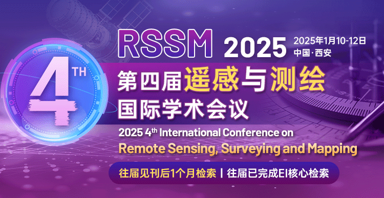
第四届遥感与测绘国际学术会议
2025 4th International Conference on Remote Sensing Surveying and Mapping
大会简介
遥感与测绘技术,在全球变化、生态、环境、农、林、气象、人类活动等众多领域发挥了重要作用,受到世界各国高度重视。综合挖掘数据信息,生产多尺度遥感与测绘产品,开展尺度转换、真实性检验产品的分析与应用是遥感与测绘的本质,也是科学的核心。
为拉进近年来国外国内遥感、测绘领域在理论、技术与应用等方面的最新进展,展示最新成果,第四届遥感与测绘国际学术会议(RSSM 2025)将于2025年1月10-12日在西安召开,为遥感、测绘相关的师生学者、研究人员提供一个共享科研成果和前沿技术,了解学术发展趋势的平台。本次会议诚邀国内外相关领域的知名专家学者出席会议,在大会上通过主题演讲、口头报告等方式与学者们分享最新研究成果、交流探讨学术难题。期待在大会上与各位相见!
技术委员会主席:
汪长城教授,中南大学
陆建忠副教授,武汉大学
出版主席:
周涛教授,北方民族大学(二级教授)
吴金建教授,西安电子科技大学(国家级青年人才、陕西省青年人才、教育部霍英东青年基金获得者,IEEE Senior Member)
王卷乐教授,中国科学院大学
论文出版
所有的投稿都必须经过 2-3 位组委会专家审稿,经过严格的审稿之后,最终所有被录用的稿件将发表在会议论文集,出版后提交EI Compendex 和 Scopus 检索,目前该检索非常稳定。
征稿主题
地理科学
地图学
城市空间信息学
变形与沉陷工程学
合成孔径雷达
数字测图
摄影测量学 / 大地测量学 / 工程测量学等
矢量化测绘、三维测绘、地理信息系统(GIS)
全球导航卫星系统(GNSS)、全球定位和导航系统
图像数字处理技术
遥感信息提取技术
大数据分析与处理技术
数字图像处理技术
变形监测数据处理技术
精密测绘仪器
分类和数据挖掘技术
使用传感器技术来检测和分类地球上的物体
无人机航测技术
计算机视觉与机器学习在遥感与测绘中的应用
基于遥感数据监测的计算机算法与模型
遥感技术在地质矿产勘查中的应用
遥感数据融合及应用
光学遥感及应用
高光谱影像处理及应用
遥感在资源普查中的应用
遥感在环境和灾害检测中的应用
遥感技术在农业方面的应用
测绘在土地规划、道路建设、矿区开发、水利工程、城市规划等领域的应用
2025 4th International Conference on Remote Sensing Surveying and Mapping
Xi‘an China | January 10-12 2025
Remote sensing Surveying and Mapping technology have played an important role in many fields such as global change ecology environment agriculture forestry meteorology human activities and so on and are highly valued by countries all over the world. Mining data information comprehensively producing multi-scale remote sensing and mapping products carrying out scale conversion analysis and application of authenticity inspection products are the essence of remote sensing and mapping and also the core of science. In order to bring in the latest progress in theory technology and application in the field of remote sensing and surveying at home and abroad in recent years and show the latest achievements 2025 4th International Conference on Remote Sensing Surveying and Mapping (RSSM 2025) will be held in Xi‘an China on January 10-12 2025.
IMPORTANT DATES
Full Paper Submission Deadline
September 26 2024
Registration Deadline
September 27 2024
Conference Dates
January 10-12 2025
Plenary Speaker
Prof. Shuanggen Jin Henan Polytechnic University China
金双根教授,河南理工大学副校长
Fellow of Electromagnetics Academy Member of European Academy of Sciences Member of Academia Europaea Fellow of African Academy of Sciences
Shuanggen Jin is Vice-President at Henan Polytechnic University Jiaozuo China. His main research areas include satellite navigation remote sensing and space/planetary exploration. He has published over 500 papers in peer-reviewed journals and proceedings 20 patents/software copyrights and 12 books/monographs with more than 12000 citations and H-index>60. He has received World Class Professor of Ministry of Education and Cultures Indonesia Fellow of IAG Fellow of IUGG Fellow of African Academy of Sciences Fellow of Electromagnetics Academy Member of European Academy of Sciences and Member of Academia Europaea.
Prof. Wang Lunche China University of Geosciences
王伦澈教授,中国地质大学地理与信息工程学院副院长
王伦澈,教授、博导、副院长,地理学一级学科责任教授,国家级青年人才计划入选者,九三学社湖北省委常委、科技专委会主任。兼任教育部高等学校地理科学类专业教学指导委员会委员,中国地理学会地理大数据工作委员会副主任,中国青年科技工作者协会环境与能源科学专委会委员,国际大气环境遥感学会(AERSS)创始理事、第十工作组(辐射与生态)主席等相关专委会委员、副主任;区域生态过程与环境演变湖北省重点实验室常务副主任、洞庭湖区生态环境遥感监测湖南省重点实验室副主任。Natural Hazards、Frontiers in Environmental Science、Journal of Earth Science期刊副编辑(Associate Editor),Science of the Total Environment、Remote Sensing、遥感学报、长江流域资源与环境等期刊编委。从事区域地表信息监测与生态环境遥感等方向工作,近五年主持国家自然科学基金项目3项,在Remote Sensing of Environment、Geophysical Research Letters、Renewable and Sustainable Energy Reviews、Environment International、地理学报、遥感学报等期刊发表第一/通讯作者SCI论文150余篇,ESI高被引/热点论文15篇,被SCI论文引用5000余次,获湖北省高等学校教学成果二等奖、测绘科技进步二等奖、地理信息科技进步二等奖等,2017-2022年间指导的团队研究生中有22人次获得国家奖学金。
Prof. Weicheng Wu East China University of Technology
吴伟成教授,东华理工大学数字化国土重点实验室特聘教授
PhD in Environmental Geography from the University of Paris I (2003) Dr Wu won the ti
Call For Papers
The topics of interest for submission include but are not limited to:
· Geographic Sciences Cartography
· Urban Spatial Information
· Deformation and Subsidence Engineering
· Synthetic Aperture Radar (SAR)
· Digital Mapping
· Photogrammetry / Geodesy / Engineering Surveying etc.
· Vectorized Mapping 3D Mapping
· Geographic Information System (GIS)
· Global Navigation Satellite System (GNSS) Global Positioning and Navigation System (GPS)
· Image Digital Processing Technology
· Remote Sensing Information Extraction Technology
· Big Data Analysis and Processing Technology
· Digital Image Processing Technology
· Deformation Monitoring Data Processing Technology
· Precision Mapping Instruments
· Classification and Data Mining Technology
· Use of Sensor Technology for Detection and Classification of ob
· Aerial Surveying Technology by Unmanned Aerial Vehicles
· Application of Computer Vision and Machine Learning in Remote Sensing and Mapping
· Computer Algorithms and Models for Monitoring Remote Sensing ba
· Application of Remote Sensing Technology in Geological and Mineral Exploration
· Remote Sensing Data Fusion and Application
· Optical Remote Sensing and Application
· Hyperspectral Image Processing and Application
· Application of Remote Sensing in Resource Census
· Application of Remote Sensing in Environment and Disaster Detection
· Application of Remote Sensing Technology in Agriculture
· Application of Surveying and Mapping in the fields of Land Planning
· Road Construction Mining Development Water Conservancy Engineering and Urban Planning
Publication
● All papers will be reviewed by two or three expert reviewers from the conference committees. After a careful reviewing process all accepted papers will be published in the Conference Proceedings and submitted to EI Compendex Scopus for indexing.
Note: All submitted articles should report original previously unpublished research results experimental or theoretical. Articles submitted to the conference should meet these criteria and must not be under consideration for publication elsewhere. We firmly believe that ethical conduct is the most essential virtual of any academic. Hence any act of plagiarism is a totally unacceptable academic misconduct and cannot be tolerated.


