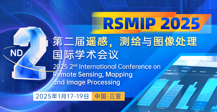
第二届遥感、测绘与图像处理国际学术会议
2025 2nd International Conference on Remote Sensing Mapping and Image Processing
大会简介
第二届遥感、测绘与图像处理国际学术会议(RSMIP 2025)将于2025年1月17日-19日在中国三亚举行。会议主要围绕遥感、测绘与图像处理等研究领域展开讨论。本次会议旨在为相关领域的研究人员提供一个权威的国际交流平台,交流全球相关领域科技学术最新发展趋势,链接重点领域国内外顶尖、活跃、最新学术资源,通过经验分享和智慧碰撞,推动科研学术成果转化和人才、技术、资本聚集,提升发展新动能。大会诚邀国内外高校、科研机构专家、学者,企业界人士及其他相关人员参会交流。
往届主讲嘉宾
高智教授,武汉大学,中国
武汉大学遥感与信息工程学院副院长,国家海-外-高-层-次人才计划(青年项目)获得者,湖北省楚天学者特聘教授,湖北省杰青,国家自然科学基金委重大项目课题负责人。目前担任中国湖北珞珈实验室工作委员会副主任。获得了“国家青年计划”奖和湖北省杰出青年科学家基金,湖北省“楚天学者”特聘教授。高智教授长期从事人工智能、计算机视觉与智能无人系统相关的核心问题研究,及其在测绘遥感领域的应用研究。
余科根教授,中国矿业大学,中国
博士生导师,中国矿业大学环境与测绘学院特聘教授。2015年荣获湖北省特聘专家称号。2013-2017,连续5年担任三个国际SCI期刊编委(IEEE TVT、IEEE TAES、EURASIP JASP),作为第一客座编辑,先后主办6个SCI期刊专辑。在无线定位与导航领域出版五部英文学术专著,分别由 IEEE-Wiley Press、Springer Nature、科学出版社等国内外知名出版社出版,其中三部获得亚马逊网站好评,参与写作超宽带通讯和遥感等领域5部英文学术专著,发表SCI期刊论文100余篇,IEEE高级会员。
征稿主题
遥感
环境遥感
光学遥感
图象数据处理技术
高光谱影像处理
遥感信息提取
大数据分析与处理
全球定位和导航系统
合成孔径雷达
分类和数据挖掘技术
微波遥感
行星遥感与测图
测绘
摄影测量学
测绘技术
精密测绘仪器
原理与应用
数字测图
变形监测数据处理
数字图像处理
地理科学
地图学
城市空间信息学
变形与沉陷工程学
图像处理
图像传输
图像和视频感知和质量模型
图像存储、检索和身份验证
数字信号处理
光信号处理
图像采集
模式识别与分析
图像压缩
图像处理体系结构
文档图像处理
图像编码与压缩
实时信号处理
图像处理
修复和增强
图像扫描
人脸识别
图像分割
立体电视
数码摄影
图像特征提取
论文出版
所有的投稿都必须经过2-3位组委会专家审稿,经过严格的审稿之后,最终所有录用的论文将录用论文将以会议论文集的形式提交SPIE - The International Society for Optical Engineering (ISSN: 0277-786X)出版,见刊后由期刊社提交至 EI Compendex, SCOPUS 检索,目前该出版社EI检索非常稳定。
◆论文不得少于4页。
◆会议论文模板下载→ 前往“资料下载”栏目下载
◆每篇录用的论文可享受一名免费参会(口头报告或海报展示)的名额
◆付款后因个人原因撤稿,将收取服务费(版面费的30%)
◆论文应具有学术或实用价值,未在国内外学术期刊或会议发表过,作者可通过iThenticate、CrossCheck、Turnitin或其他查询系统自费查重,否则由文章重复率引起的被拒稿将由作者自行承担责任
◆论文需满足EI检索基本稿件要求,在论文表述上务必侧重于模型,数据,实验,数据分析等,出版社对论文录用具有最终决定权。
◆会议仅接受全英稿件。如需翻译服务,请联系会议负责人
- About RSMIP 2025 -
Following the successful of RSMIP 2024 RSMIP 2025 will be held in Sanya during January 17-19 2025. Surveying and mappinng remote sensing is a burgeoning technology field. It has concentrated on earth science biology and other disciplines of the latest achievements in the earth system science resources and environment science as well as agriculture forestry geology hydrology mapping and other sciences and major development of the national economy playing an increasing role. Remote sensing geographic information system technology and recently developed global positioning technology have led to great changes in the scope content nature and methods of earth science research marking a revolution in earth science. There is great potential for sustainable development and significant impact change.
Internet of Things Planned highlights of RSMIP 2025 include:
●Addresses by some of the most respected researchers in the Remote Sensing Mapping and surving and Image Processing
●Presentations of accepted academic and practitioner research papers; a poster paper session
IMPORTANT DATES
Full Paper Submission Date
October 19 2024
Registration Deadline
January 17 2025
Final Paper Submission Date
October 19 2024
Conference Dates
January 17-19 2025
Speakers
Prof. Zhi Gao
IEEE Member Wuhan University
Prof. Bin Zou
IEEE Member Central South University China
Prof. Kegen Yu
IEEE Senior Member China University of Mining and TechnologyChina
CALL FOR PAPERS
The topics of interest for submission include but are not limited to:
Remote Sensing
Environmental Remote Sensing
Optical Remote Sensing
Image Data Processing Technology
Hyperspectral Image Processing
Remote Sensing Information Extraction
Big Data Analysis and Processing
Optical Remote Sensing
Global Positioning and Navigation System
Synthetic Aperture Radar
Classification and Data Mining Techniques
Microwave Remote Sensing
Planetary Remote Sensing and Mapping
Other relevant topics
Surveying and mapping
Photogrammetry
Surveying and Mapping Technology
Precision Surveying and Mapping Instrument
Principle and Application of GPS
Digital Mapping
Deformation Monitoring Data Processing
Digital Image Processing
Geographical Science
Cartography
Other relevant topics
Image Processing
Image transmission
Image and video perception and quality models
Image storage retrieval and authentication
Digital signal processing
Optical signal processing
Image acquisition
Pattern recognition and analysis
Image compression
Image processing architecture
Document image processing
Image coding and compression
Real-time signal processing
Image processing
Repair and enhancement
Image scanning
Face recognition
Image segmentation
stereovision
Digital photography
Image feature extraction
Other relevant topics
Publication
Submit to Conference Proceedings (EI)
All accepted full papers will be published in the conference proceedings and will be submitted to EI Compendex / Scopus for indexing.
Note: All submitted articles should report original research results experimental or theoretical not previously published or under consideration for publication elsewhere. Articles submitted to the conference should meet these criteria. We firmly believe that ethical conduct is the most essential virtue of any academics. Hence any act of plagiarism or other misconduct is totally unacceptable and cannot be tolerated.


