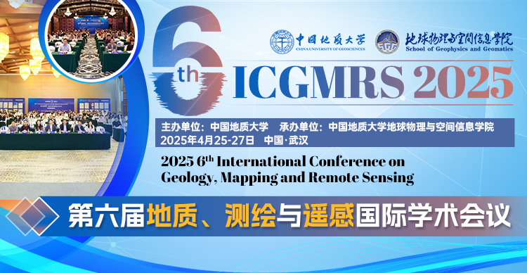
第六届地质、测绘与遥感国际学术会议
2025 6th International Conference on Geology Mapping and Remote Sensing
大会简介
为交流近年来国外在地质、测绘、遥感和海洋通信领域理论、技术和应用的最新进展,展示最新成果。由中国地质大学主办的 第六届国际地质、测绘与遥感大会(ICGMRS 2025)将于 2025 年 4 月 25-27 日在湖北武汉召开。
地质、测绘与遥感国际学术会议(ICGMRS)自2020年起已成功举办四届,2024年第五届国际地质、测绘与遥感大会(ICGMRS 2024)由中国地质大学主办,于 2024 年 4 月 12-14 日成功举办。2023 年第四届国际地质、测绘与遥感大会(ICGMRS 2023)由中国地质大学主办,北京邮电大学、苏州科技大学(地理科学与地球信息工程学院)、湖北工业大学、电子科技大学(中国)和大诺伊达理工学院(印度)协办。 2022 第三届国际地质、测绘与遥感大会(ICGMRS 2022)由舟山市人民政府、中国遥感应用协会、浙江省地理学会指导,浙江海洋大学主办。会议报告内容和参会人员体现了研究领域齐全、学术交流顺畅、学科交叉充分、青年人才辈出的四大特点,预示着我国地学、测绘遥感与海洋通信事业的蓬勃发展和美好未来。
组织单位
主办单位:中国地质大学(武汉)
承办单位:中国地质大学(武汉)地球物理与空间信息学院
协办单位:苏州科技大学
主讲嘉宾(往届2022-2024)
谢欢教授,同济大学(国家杰青,长聘特聘教授、测绘与地理信息学院院长;2007-2008年德国汉诺威莱布尼茨大学访问学者;入选上海市优秀学术带头人、上海市曙光学者等人才计划和荣誉称号;获国家级教学成果二等奖(排名第1)、上海市育才奖、上海市优秀教学成果一等奖、测绘地理信息教学成果奖等教学奖励;IEEE Senior Member)
袁强强教授,武汉大学(国家优青、湖北省杰青,测绘学院博导、航空航天测绘研究所党支部书记、测绘工程系副主任;3篇入选ESI热点,13篇入选ESI高被引,1篇入选2021中国百篇最具影响国际学术论文)
庄丽娜教授,中国科学院空天信息创新研究院(国家海外优青,2018年获中国科学院百 人计划人才计划支持,2015年获欧盟科技部玛丽居里学者Marie Curie Fellowships人才计划支持)
崔耀平教授,河南大学(中原青拔、河南省优青,遥感信息科学与技术学科特聘教授,爱思唯尔一区TOP期刊杰出审稿人,连续三届获河南省自然科学优秀成果二等奖)
孟祥超教授,宁波大学(浙江省杰青、宁波市领军人才、包玉刚青年拔尖学者,作为项目负责人承担国家自然科学基金面上项目、青年基金、浙江省基金、宁波市基金等,多篇高被引用及热点论文)
王永志教授,苏州科技大学(入选江西省“青年井冈学者奖励计划”和江西理工大学“清江人才计划”(青年拔尖人才),2019年获评江西省优秀测绘地理信息科技青年人才、2018年度江西理工大学青年科技标兵等)
汪源教授,南京信息工程大学(多篇SCI及一区TOP论文、高被引论文,曾获“李小文遥感科学青年奖”(全国每2年评选5人)、“武汉大学十大学术之星”、“王之卓创新人才奖”以及“武汉大学研究生学术创新一等奖”等10余项荣誉)
孟溪,中国电信研究院(无线频谱及调控、空-天-地-海一体化网络和物理层设计专家,积极加入了 ITU-R WP5D、3GPP RAN、APT等中国地方标准组织,如IMT-2030、CCS和 FuTURE论坛,现为ITU-R WP5D工作组主席)
隋泽平研究员,英国贝尔法斯特女王大学(参与多项中国国家自然科学基金项目、英国科技创新与技术部(DSIT)以及英国工程和自然科学研究理事会(EPSRC)项目,曾于新加坡科技研究局(A*STAR)信息技术研究所担任研究助理)
刘欣鑫副教授,湖南大学(博士生导师,中国图象图形学学会遥感图像专业委会委员、湖南省人工智能学会青工委委员)
昌毅副教授,华中科技大学(入选博士后创新人才支持计划、武汉英才优秀青年人才、小米青年学者等,作为负责人主持国基金面上/青年、装发“慧眼行动”、装发共用信息系统课题、装发重点实验室基金、华为海思横向课题等)
谢文武副教授,湖南理工学院(主持湖南省级进项及项目多项,兼任湖南省高校重点实验室“复杂网络与嵌入式系统”副主任及湖南省通信协会理事。2007-2017年曾于多家国际知名企业如展讯、MTK、中兴等工作)
陈勇讲师,江西师范大学(江西省杰青,首批赣鄱俊才支持计划·青年科技人才托举项目入选者,博士期间获日本理化学研究所(RIKEN AIP)全额资助并访问一年)
征稿主题
■ 测绘
- - 摄影测量
- - 航空摄影测量
- - 制图学
- - 城市大脑、智能海洋和数字地球
- - 计算机制图
- - 图形图像复制技术
- - 传感器技术
- - 测绘技术
- - 测绘仪器
- ...
■ 遥感
- - 光学遥感
- - 微波遥感
- - 大气环境遥感
- - 行星遥感和测绘
- - 遥感信息工程
- - 地理信息系统
- - 全球导航卫星系统
- - 卫星导航与定位
- - 空间数据库
- - 地球监测与制图
- - 空间技术与景观
- ...
■ 遥感技术应用
- - 对碳中性和碳排放的遥感监测
- - 遥感监测全球变化的关键气候因素
- - 遥感、地理信息系统(GIS)和导航定位系统(3S)的集成与应用
- - 气象应用
- - 海洋应用
- - 生态与环境应用
- - 交通应用
- - 城市建设应用
- - 灾害评估、监测和管理
- - 全球变化研究
- ...
■ 海洋通信
- - 6G 海上遥感信息传输技术及相关应用
- - 智能海事通信
- - 5G 海洋应用
- - 海事卫星通信
- - 水下声学通信
- - 海事通信信道建模
- - 水下可见光通信
- - 海事定位和导航技术
- - 电子导航
- - 人工智能海事网络
- - 海事物联网
- ...
论文出版
1、会议论文集
所有的投稿都必须经过2-3位组委会专家审稿,经过严格的审稿之后,录用的论文由会议论文集出版,见刊后由出版社对应提交至EI Compendex、Scopus等数据库。
2、SCI期刊(长期征集)
Journal 1:Frontiers in Earth Science (ISSN: 2296-6463,IF=3.498)
Journal 2:Journal of Marine Science and Engineering(ISSN:2077-1312,IF=2.458)
Journal 3:Geo-spatial Information Science(ISSN:1009-5020,IF=4.288)
Journal 4:Journal of Nanoelectronics and Optoelectronics(ISSN:1555-130X,IF=0.961)
?额外征集优秀论文,按SCI期刊论文要求审稿,直接推荐至包括并不限于以上SCI期刊发表。
3、Journal of Environmental & Earth Sciences
期刊名称:Journal of Environmental & Earth Sciences(Online ISSN: 2661-3190)
期刊简介:该刊涵盖范围广泛,发表环境与地球科学的创新方法和科学发现以及人类活动、自然资源、环境或气候变化之间的重要相互作用的原创成果。
检索数据库:Scopus/EI GeoBase/CAS/J-gate/Google Scholar /知网/维普/Scilit/ICI/BASE/WorldCat/百度学术等
*由AEIC推荐的论文将有机会得到期刊编辑的快速预审。如有疑问,请联系温老师(微信:17620001794)。 欢迎向Journal of Environmental & Earth Sciences提交您的文章或会议论文的拓展版本。
Welcome to ICGMRS 2025!
2025 6th International Conference on Geology Mapping and Remote Sensing
To exchange the latest progress in theory technology and application in the field of geology mapping remote sensing and marine communication in foreign countries in recent years and to show the latest achievements. Hosted by China University of Geosciences 2025 6th International Conference on Geology Mapping and Remote Sensing (ICGMRS 2025) will be held in Wuhan Hubei on April 25-27 2025.
The International Conference on Geology Mapping and Remote Sensing has been successfully held three times since 2020. 2024 5th International Conference on Geology Mapping and Remote Sensing (ICGMRS 2024) hosted by China University of Geosciences was successfully held from April 12-14 2024. The 2023 4th International Conference on Geology Mapping and Remote Sensing (ICGMRS 2023) was hosted by China University of Geosciences and co-organized by Beijing University of Posts and Telecommunications Suzhou University of Science and Technology (School of Geography Science and Geomatics Engineering) Hubei University of Technology University of Electronic Science and Technology (China) and Greater Noida Institute of Technology (India).The 2022 3rd International Conference on Geology Mapping and Remote Sensing (ICGMRS 2022) was guided by Zhoushan Municipal Government China Association of Remote sensing Application The Geographical Society of Zhejiang Province and hosted by Zhejiang Ocean University. The content of the conference reports and the participants reflected the four characteristics of complete research fields smooth academic exchanges sufficient interdisciplinary crossover and young talents which foretell the prosperous development and bright future of geology mapping remote sensing and ocean communication in China.
Early Bird Discount:Register before December 15 2024
Full Paper Submission Date:January 31 2025
Final Paper Submission Date: April 1 2025
Conference Dates:April 25-27 2025
Call For Papers
The topics of interest for submission include but are not limited to:
■ Surveying & Mapping
- · Photogrammetry
- · Aerial Photogrammetry
- · Cartography
- · City Brains Smart Oceans and Digital Earth
- · Computer Graphics
- · Graphic Image Copy Technology
- · Sensor Technology
- · Mapping Technology
- · Surveying and Mapping Instruments
■ Remote Sensing
- · Optical Remote Sensing
- · Microwave Remote Sensing
- · Remote Sensing of Atmospheric Environment
- · Planetary Remote Sensing and Mapping=
- · Remote Sensing Information Engineering
- · Geographic Information System
- · Global Navigation Satellite System
- · Satellite Navigation and Positioning
- · Spatial Databa
se - · Earth Monitoring and Mapping
- · Space Technology and Landscape
- · Classification and Data Mining Techniques
- · Image Processing Technology
- · Hyperspectral Image Processing
- · Remote Sensing of Aquatic Environment
- · Deformation Monitoring Data Processing Technology
- · Digital Map
- · Remote Sensing Information Extraction Technology
■ Application of Remote Sensing Technology
- · Remote Sensing Monitoring of Carbon Neutrality and Emissions
- · Remote Sensing Monitoring of Key Climate Factors of Global Change
- · Remote Sensing GIS and Navigation and Positioning System (3S) Integration and Application
- · Meteorological Application
- · Marine Applications
- · Ecological and environmental Applications
- · Transportation Applications
- · Urban Construction Application
- · Disaster Assessment and Monitoring and Management
- · Global Change Studies
- · Renewable Energy Map
- · Remote Sensing and Data Interpretation
- · Radar Sensor
- · Spatial Information Decision
- · Big Data Analysis
- · 3D Scene Reconstruction
- · Range Image Processing
- · Virtual Globe and its Application
- · Global Satellite Navigation System and its Application
- · GPS Application
- · Web GIS / Mobile Mapping
- · Marine Communication
■ Maritime Communications
- · 6G Maritime Remote Sensing Information Transmission Technology and Related Applications
- · Intelligent Maritime Communications
- · 5G for Marine Applications
- · Maritime Satellite Communications
- · Underwater Acoustic Communications
- · Channel Modeling for Maritime Communications
- · Underwater Visible Light Communications
- · Maritime Localization and Navigation Techniques
- · E-navigation
- · AI-enabled Maritime Networks
- ·Maritime lot
Publlication
All papers will be reviewed by two or three expert reviewers from the conference committees. After a careful reviewing process all accepted papers will be published in conference proceedings which will be submitted for EI Compendex Inspec and Scopus.

